Lower Dibang Valley district is one of the administrative districts of the state of Arunachal Pradesh. Roing is its headquarters and it is actually the youngest of all districts of the state. This district forms a part of the eastern region of Arunachal Pradesh. The Lower Dibang Valley district derived its name from Dibang River, which is one of the significant tributaries of Brahmaputra River. The Lower Dibang Valley district has an abundance of natural beauty, colourful and different tribes and ancient archaeological sites. All these aspects make this district a perfect destination for the tourists across the world. The main tribal groups of this district are Mishmi tribe, Adi tribe and Mishing tribe.
History of Lower Dibang Valley District
Prior to 1914, the Lower Dibang Valley district was a portion of the Lakhimpur district. In that same year, the North East Frontier Tract was formed with three political charges and the region that was covered by Lower Dibang Valley district became a part of the Eastern Section. As per the North East Frontier Administration Regulation 1954, North-East Frontier Tract became North-East Frontier Agency. Further, the Mishmi Hills District came to be known as Lohit Frontier Division. It was in the year 1956 the Dibang Valley was created as a distinct administrative unit within the division. The Lower Dibang Valley district was formed out of the un-divided Dibang Valley district with its headquarters at Roing. It was formed according to the Amendment of Re-organization of the District Act of 1980.
Geography of Lower Dibang Valley District
The Lower Dibang Valley district is bounded by the Dibang Valley district on the north, by the Lohit district on the East and Mc Mohan Line, by the eastern and Upper Siang districts of Arunachal Pradesh on the west and by the Tinsukia district of the state of Assam on the south. The Lower Dibang Valley district is mostly hilly with rugged and steep slopes. It is located at an altitude of 390 metres above the sea level.
Tourism of Lower Dibang Valley District
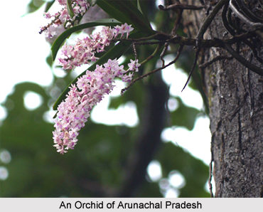
The Lower Dibang Valley district attracts the tourists with its phenomenal diversity of topography, rich flora and fauna, snow clad mountains, deep valleys, various rivers, waterfalls, lakes, archaeological sites and above all through its heavenly climate. Some of the tourist attractions of this district include Mehao Wildlife Sanctuary, Mehao Lake, Forest Park, Hunli, etc.
Thus, the Lower Dibang Valley district is aptly described as the land of captivating beauty with its lush hills and deep gorges of the Himalayan Mountain ranges.